Introduction to Design, Fall 2013
Space and Notation
Raveevarn Choksombatchai, Jay Atherton, and Kyle Steinfeld
For some, architecture begins with an understanding of the influences of site, inhabitation and event. Here, value may be found in the ability for a design to enable a particular performance in relation to its setting, and in the adherence of a design to an abstract description of experience. Systems of notation take center stage under this design approach, as architectural form responds to forces outside of the reach of traditional methods of graphic projection, instead arising through a creative and critical process of mapping.
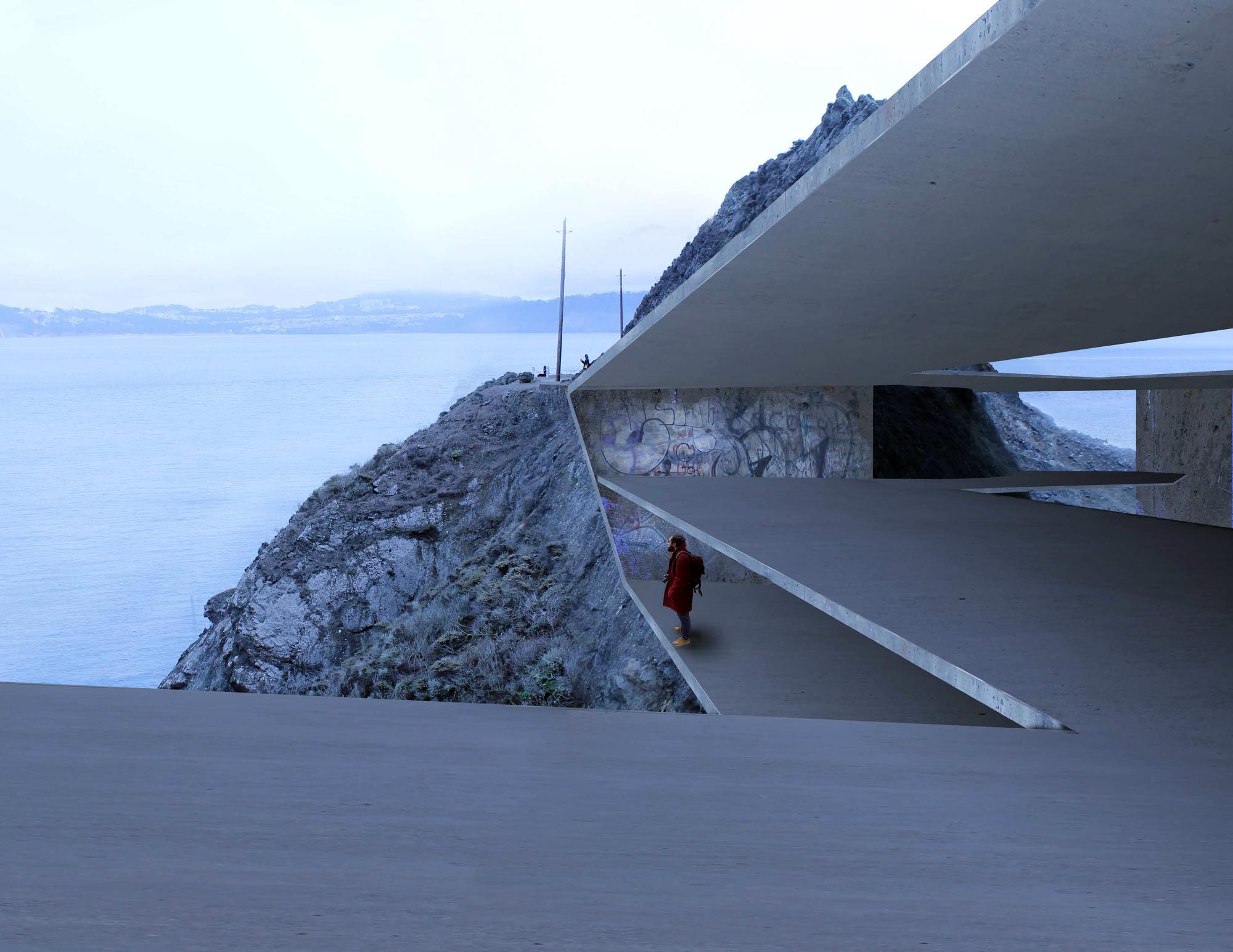
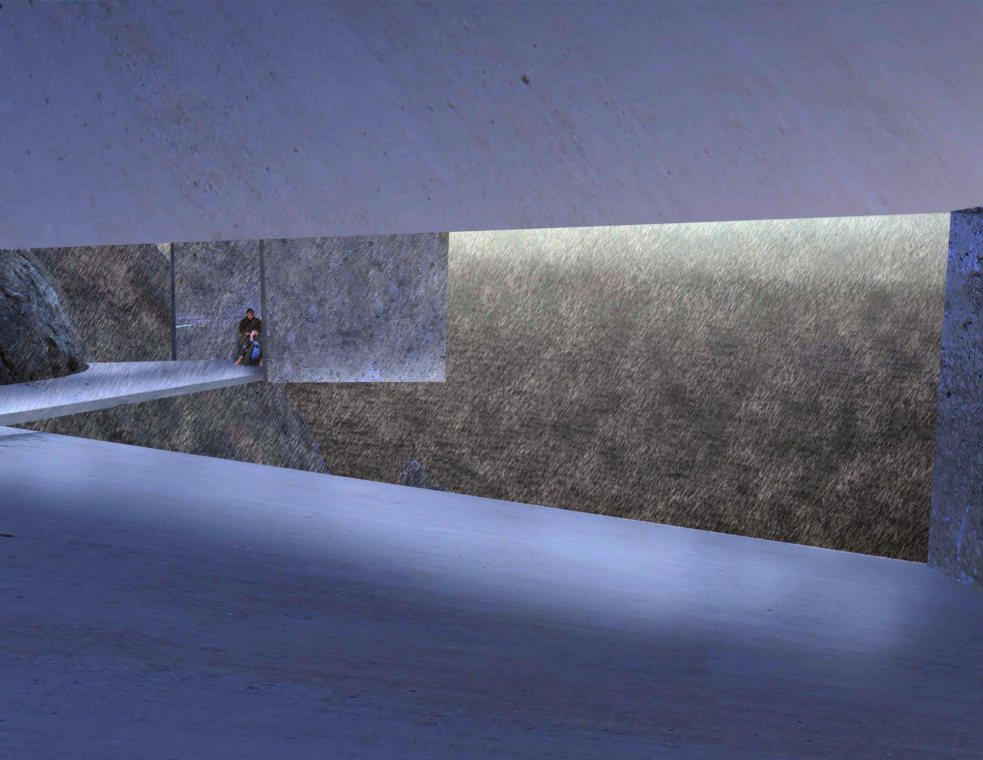
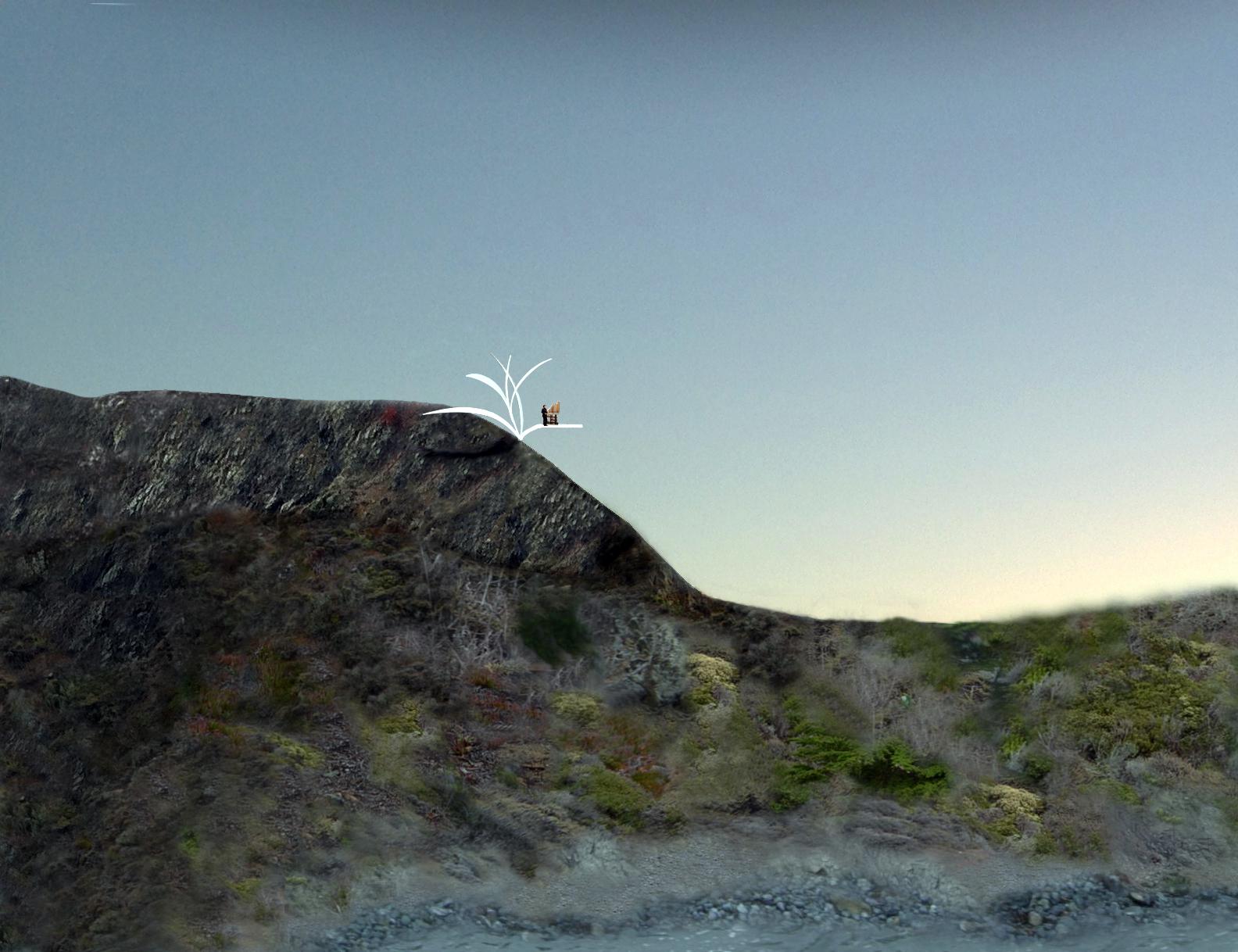
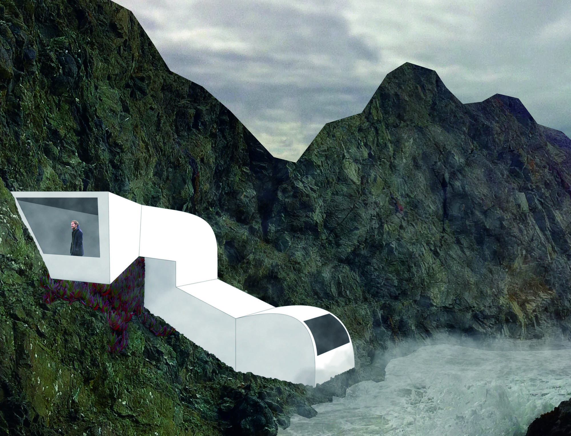
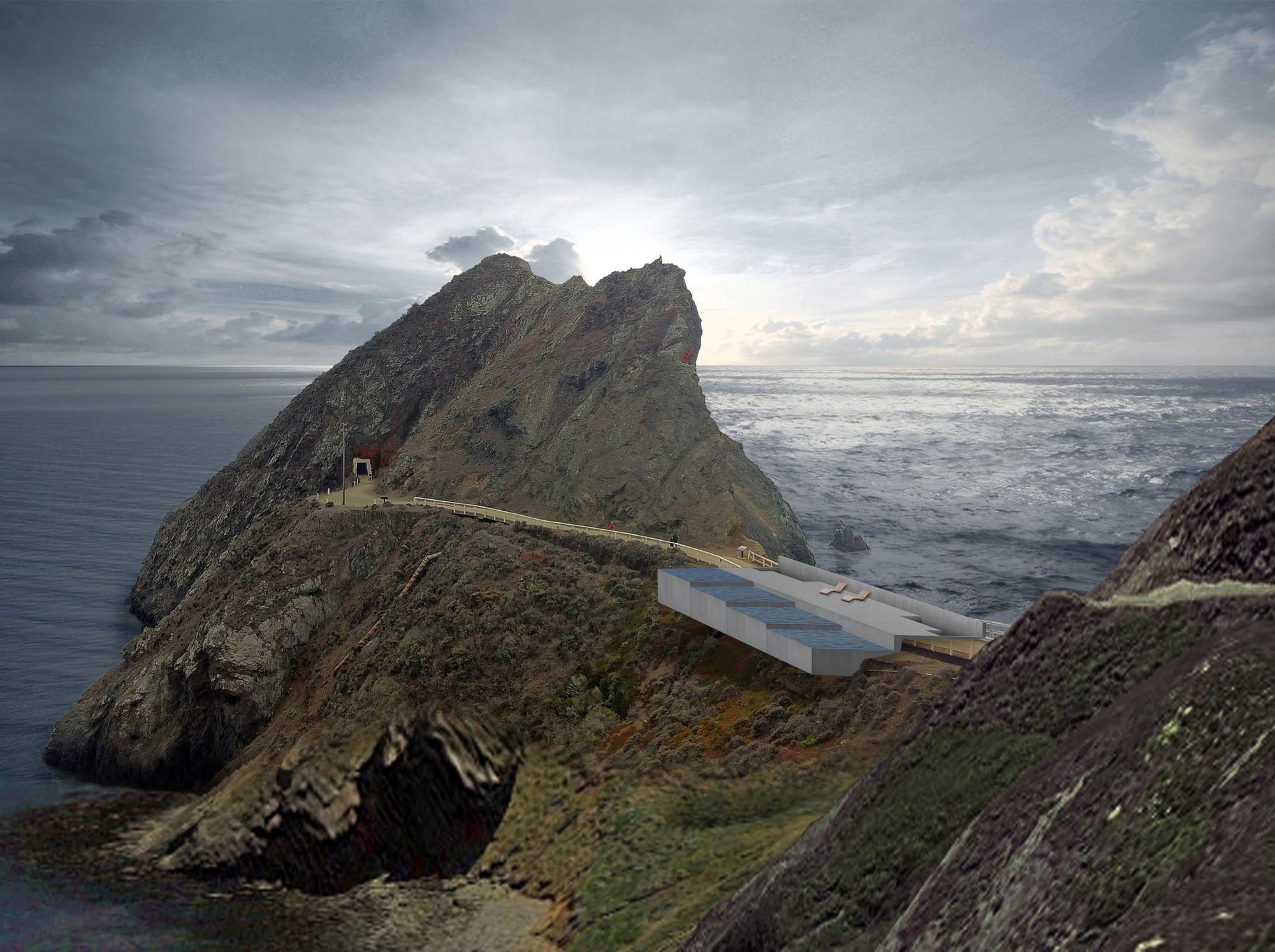
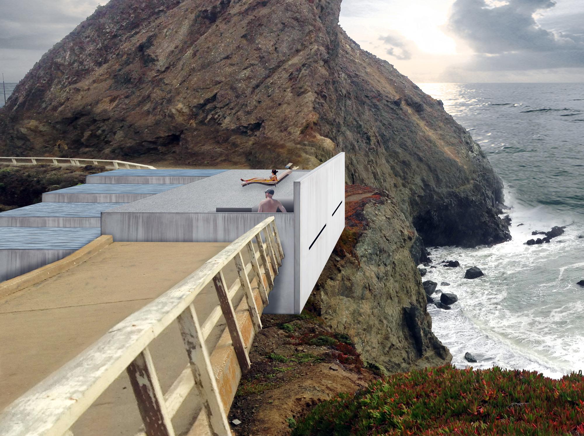
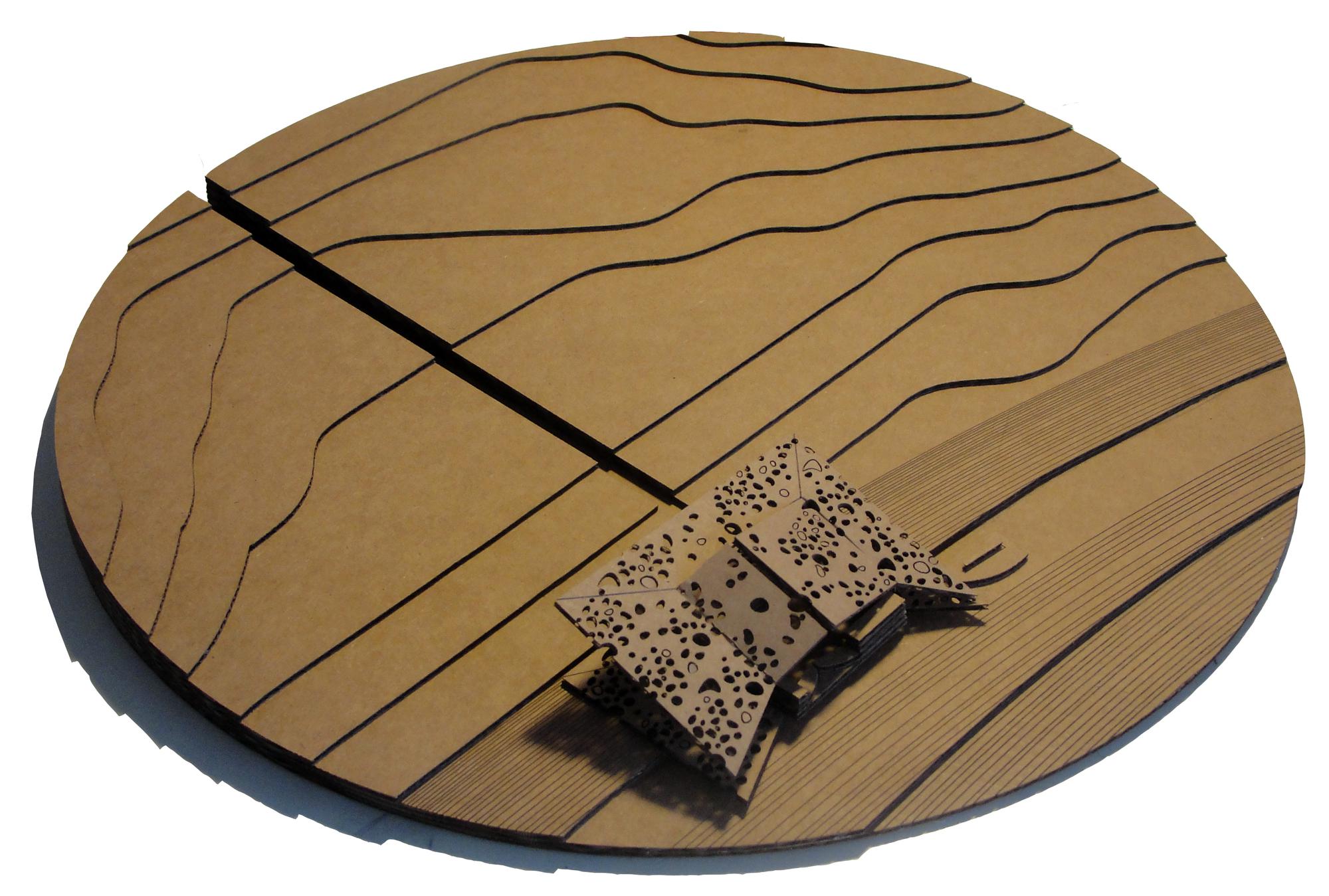
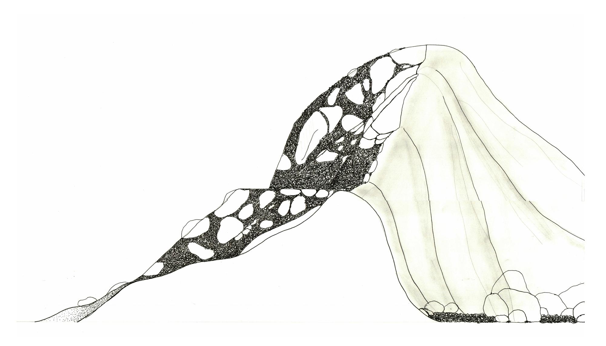
This project opens with the development of layered drawings and maps that aspire to extract the spatial and temporal dynamics of our Pt Bonita site, and to plot the larger systems of order we find guiding these phenomena. Next, working with "high-relief" spatial models that emerge from these layered graphic constructions, and also through perspectival montage that enables a speculation on the spatial experience that may result, we offer an architectural response to the phenomenological forces and abstract systems we have found latent in our site.
This approach is evident in the work of OMA, UNStudio, Reiser Umemoto, Foreign Office of Architects, Bjarke Ingels Group, Field Operations, SANAA, Enrique Morales and many others. Please note that while analytic diagrams are employed by these practices, the forms and syntax of their diagramming (and, as a result, the formal language of their architecture) are varied widely. For many of the practices listed above, this approach remains methodological, while others seek a more literal translation from diagram to built form.
This departures seeks to apply a practice of mapping, outlined by James Corner in The Agency of Mapping, as an instrument of design. In this text, Corner describes the act of mapping as a liberated practice of cartography, and argues for the more widespread application this approach both as a creative act and as a critical part of architectural design. He schematizes mapping as consisting of three basic elements: fields, extracts and plottings.
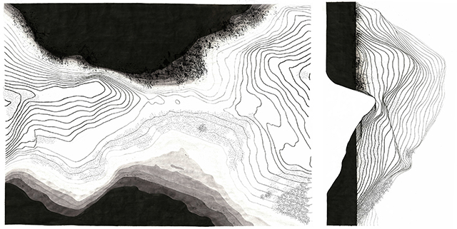
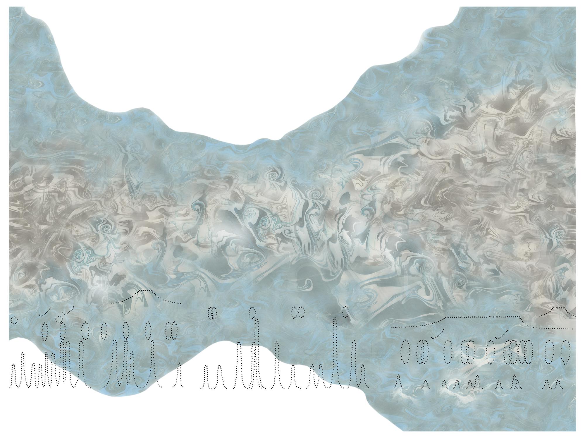
Fields are understood as the continuous surface of a drawing that is the analogical equivalent to the actual ground - the paper or the table itself - as well as the graphic system employed to depict space, form, and activity. Some maps employ conventional and easily recognizable fields - the Murcador projection represents the field of most geo-political maps we encounter - while others position the resulting map in very specific ways.
As the definition of a field encompasses very basic assumptions - from the scale, orientation, and units of measure to the choice of graphic projection method - this studio largely accepts a given definition of field in this departure: the frame of the extended Pt Bonita site, as seen from two orthographic views with which we already are quite familiar.
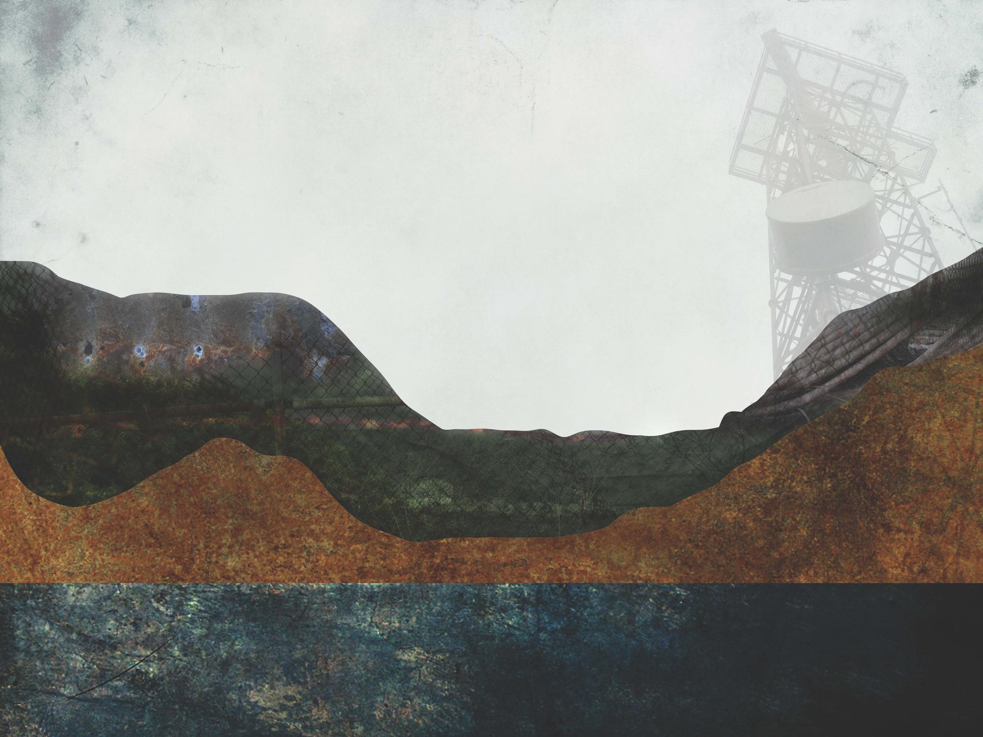
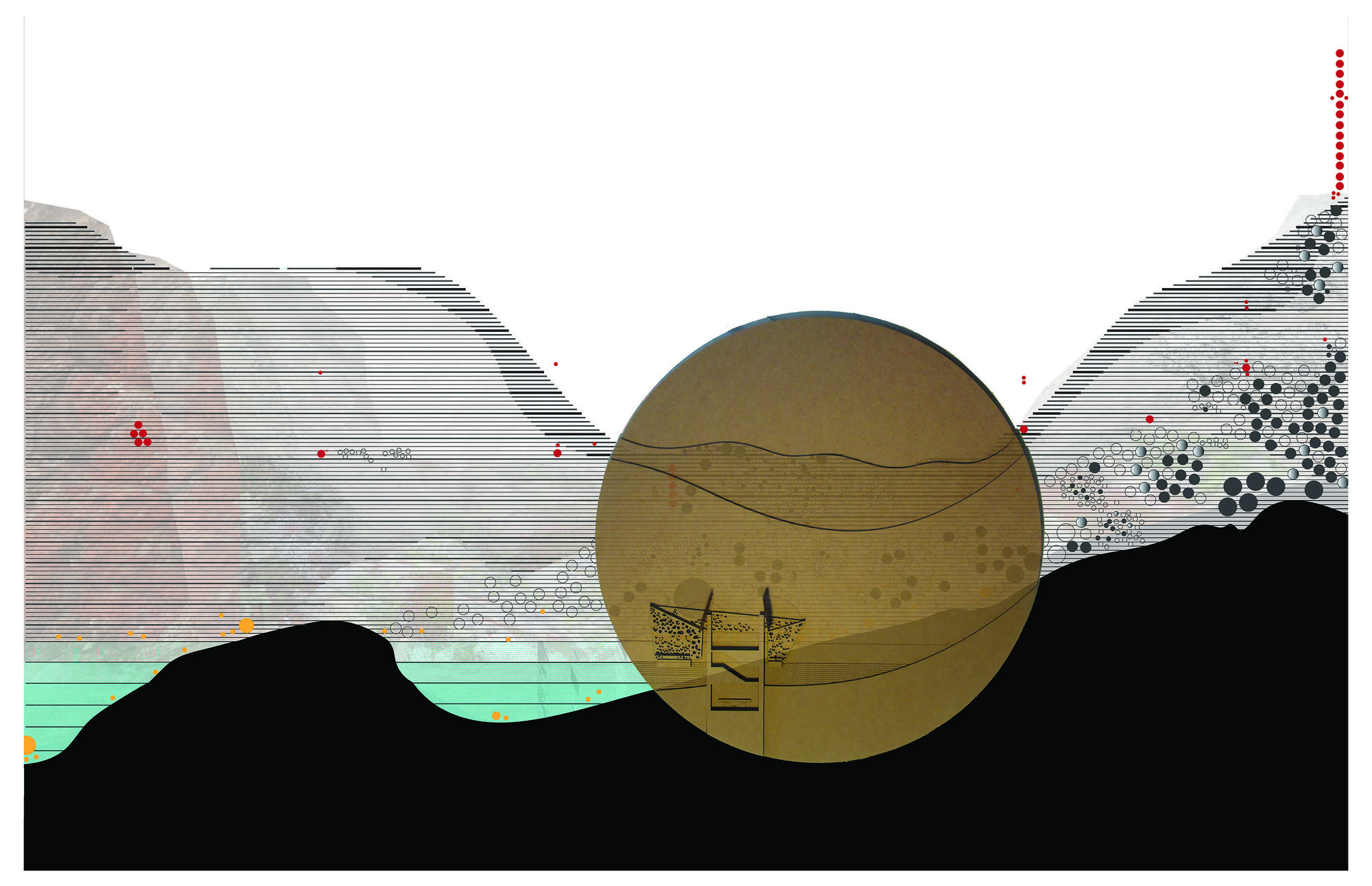
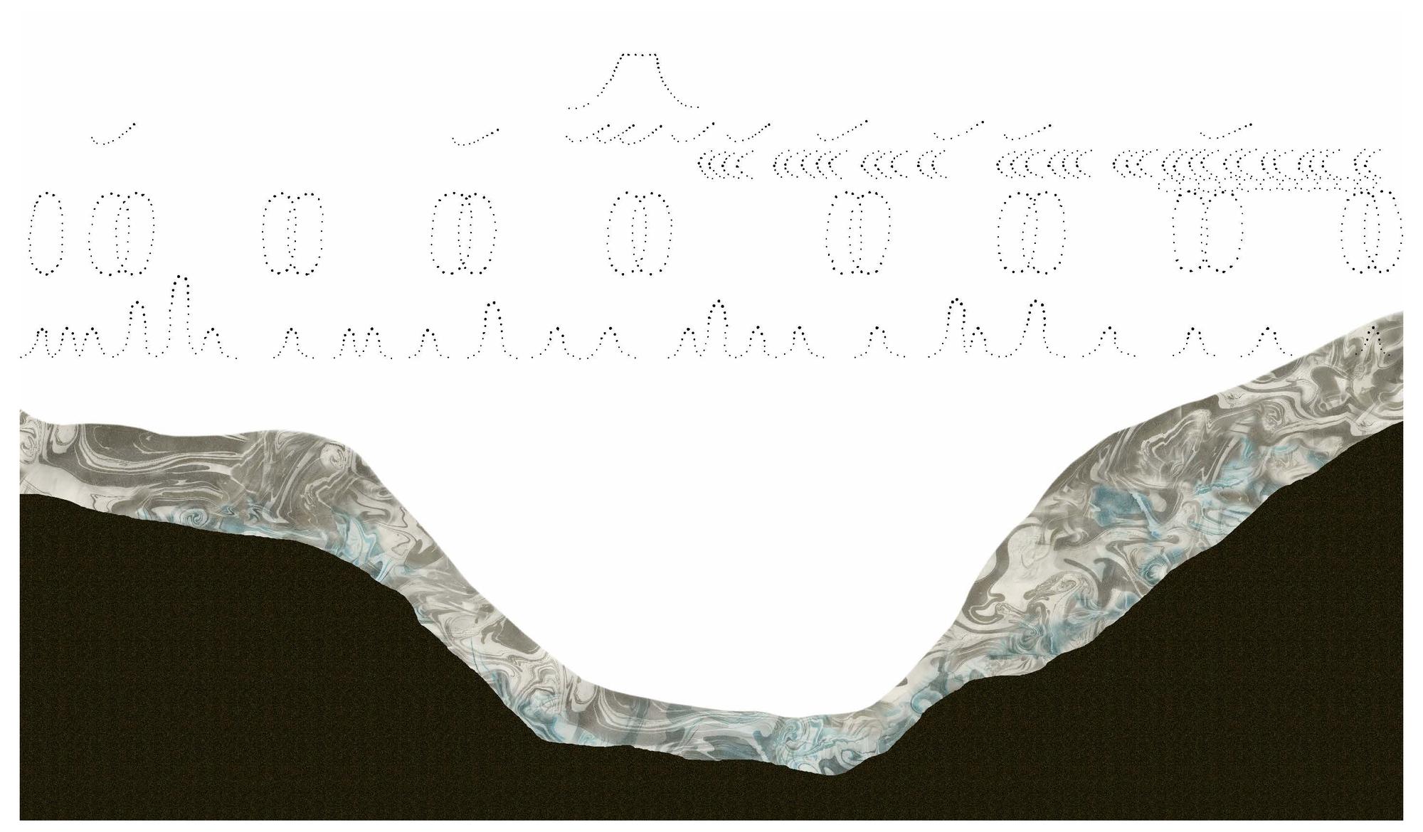
Extracts are understood as forms, spaces, events or phenomena that are observed within a given site and are then drawn into the graphic field. As graphic representations that index directly to things in the world, extracts may refer to both physical objects and more ephemeral or informational data: quantities, velocities, forces, and trajectories. As they are described through representation, extracts are necessarily de-territorialized - pulled out from their context and their original seamlessness with other things in the world and represented through the abstraction of the map. Note how a range of information may be depicted within composite graphic fields: some may composite plan and aerial perspective, for example, or may composite a plan with multiple scales of section.
Plots draw out new and latent relationships that can be found among the extracts as depicted in the field. Like extracts, plots are graphic or notational in nature, but do not derive meaning from their index to objects or events in the world, but rather from relational structures that organize and 'make sense' of extracted phenomena.
In his description of plots, Corner argues that there are some phenomena that can only achieve visibility through a representation rather than through direct experience. These phenomena are drawn out through plots, which can engender new and meaningful relationships amongst otherwise disparate elements. In this way, the relational structure described by plots is not something already 'out there', as is the case with extracts, but rather something that is actively constructed through the act of mapping. In short, where extracts de-territorialize, plots re-territorialize.
With modest adaptations to the context of this studio and site, we will adopt Corner's methods and terminology as our conceptual basis for this departure, and will seek to apply the instruments he provides us as a way to understand our site at Point Bonita.
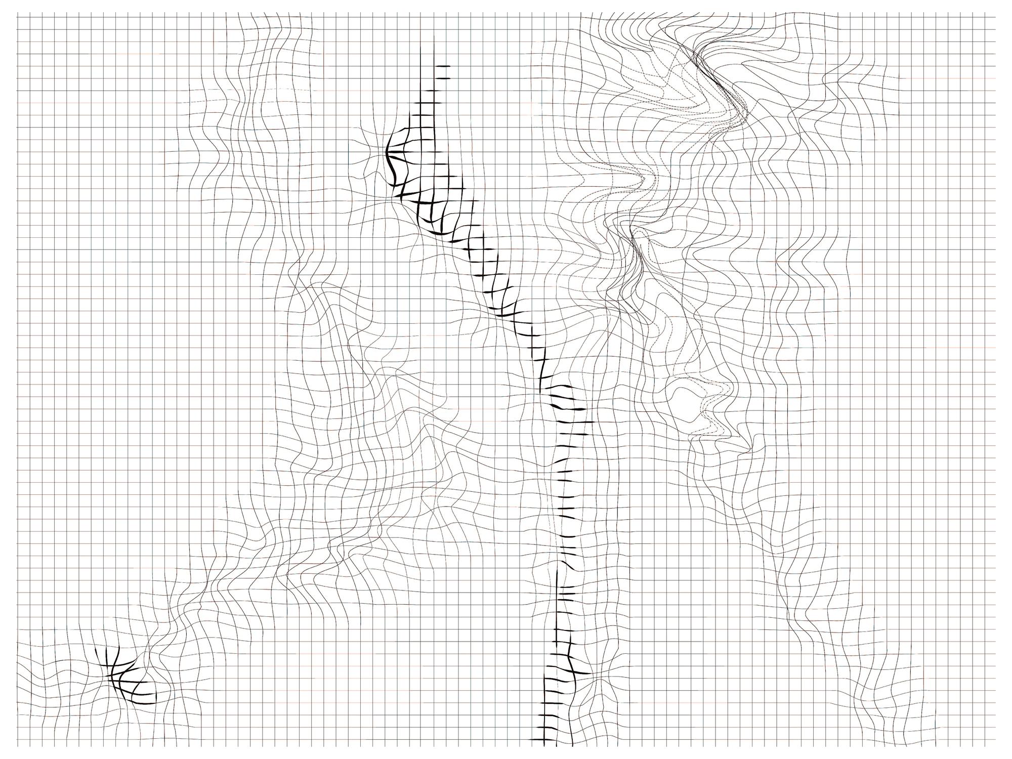
Extracts may be expressed either descriptively, through representations that bear some resemblance to the phenomena described, or notationally, through graphics that suggest a symbolic or indexical relationship to things in the world. In this departure we will employ both methods.
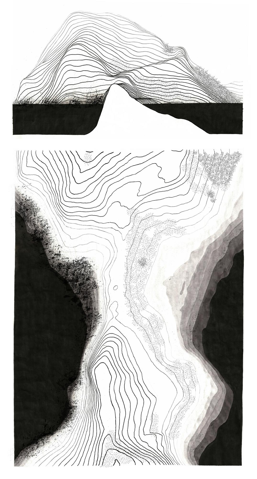
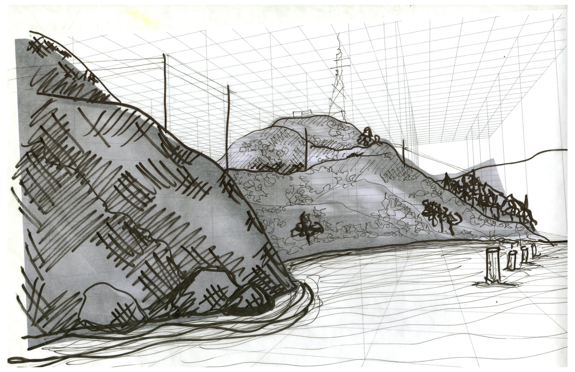
We begin with the production of two descriptive drawings which seek to extract salient phenomena from the Pt Bonita site into a descriptive graphic representation. These drawings will form a *descriptive underlay for our further mapping operations to follow.
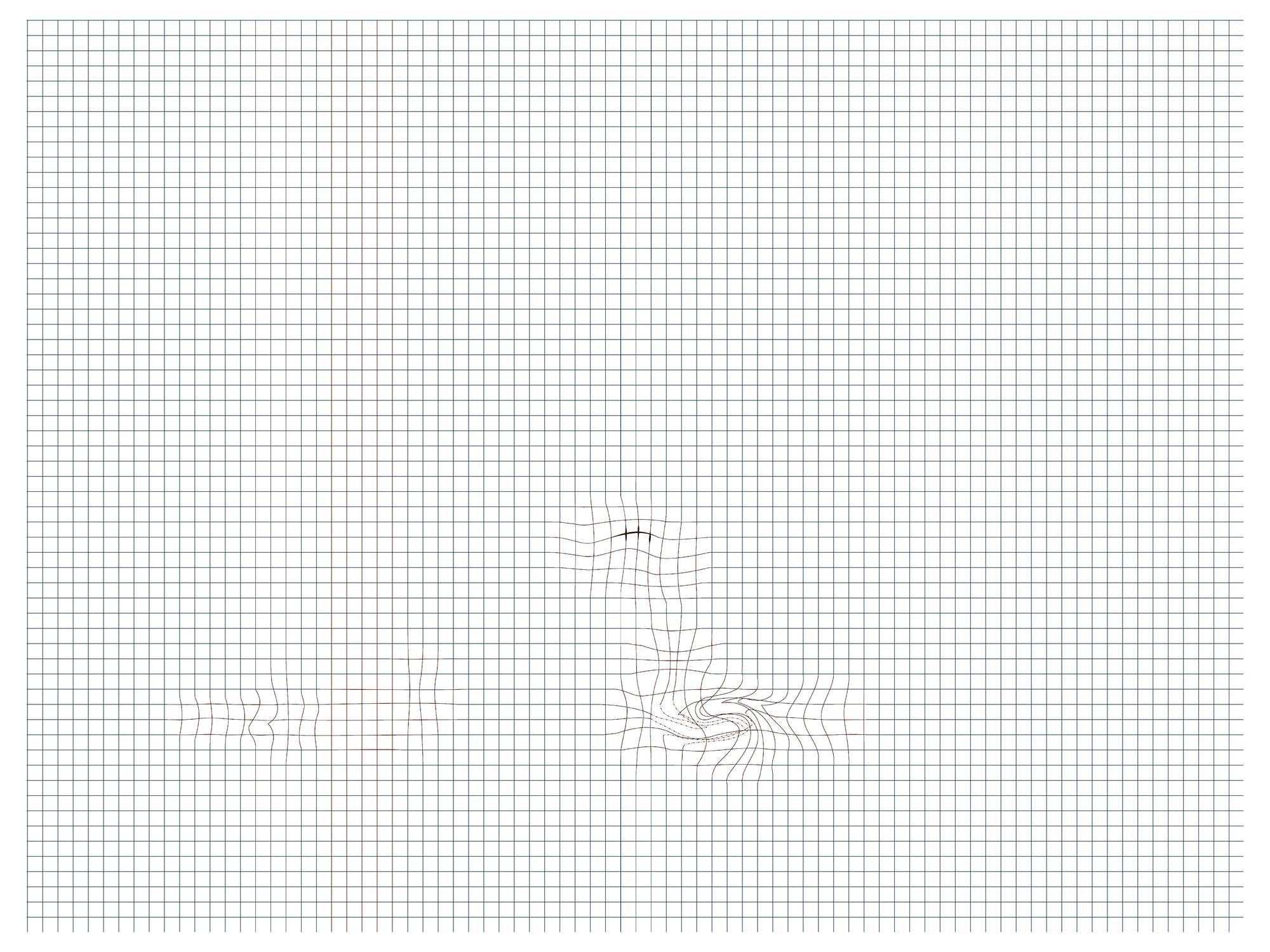
Next, we seek to represent the information extracted from Pt Bonita during a site visit using a notational graphic language. Through this notational overlay layer, we essentially construct a "world" for our architectural proposals to later inhabit. It is important in this step to address changes that occur over time, and to identify a span of time that is most important to the phenomena mapped. This time-span becomes the duration for which a space is designed for inhabitation by two occupants.
Recall Corner's assertion that an important aspect of mapping "is the acknowledgment of the maker's own participation and engagement with the cartographic process", including not only our individual experiences, biases, and imaginations, but also the set of notational instruments we bring to the site. These notational devices, which contribute to the way we map, are just as important as what we map.
Thus far, we have only aspired to capture and describe particular qualities of our site via Descriptive Underlay and Notational Overlay drawings. If these drawings describe the "world" as we see it through the lens of our own experience and the instrument of the graphic notational system we have employed to capture it - then how might this world change as a result of an architectural intervention? Which phenomena will be affected, and how? The role of our intervention may be to amplify and bring certain phenomena to the attention of the occupants of our architecture, or it may be to mitigate or provide contrasting effects. Working through the methods described here, students form an architectural response and seek to address these questions.
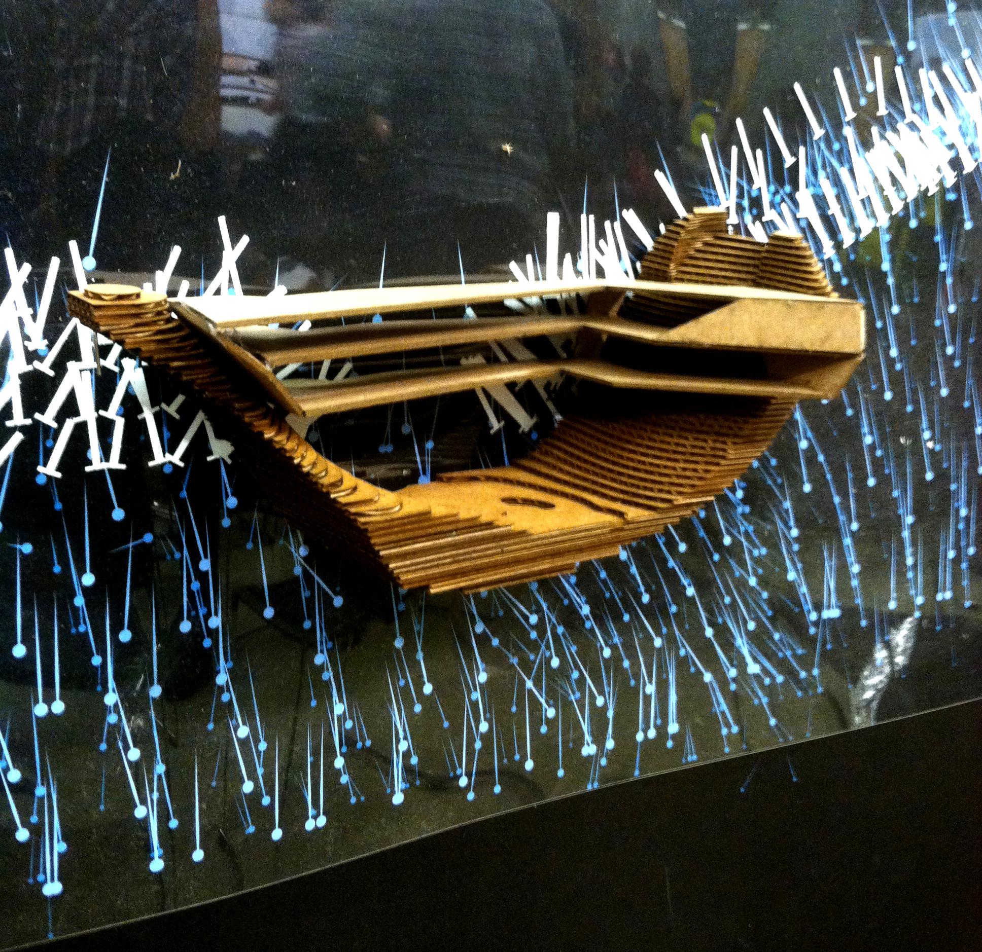
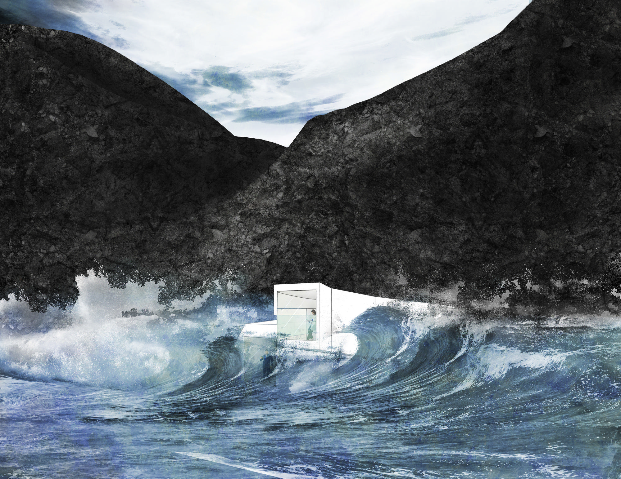
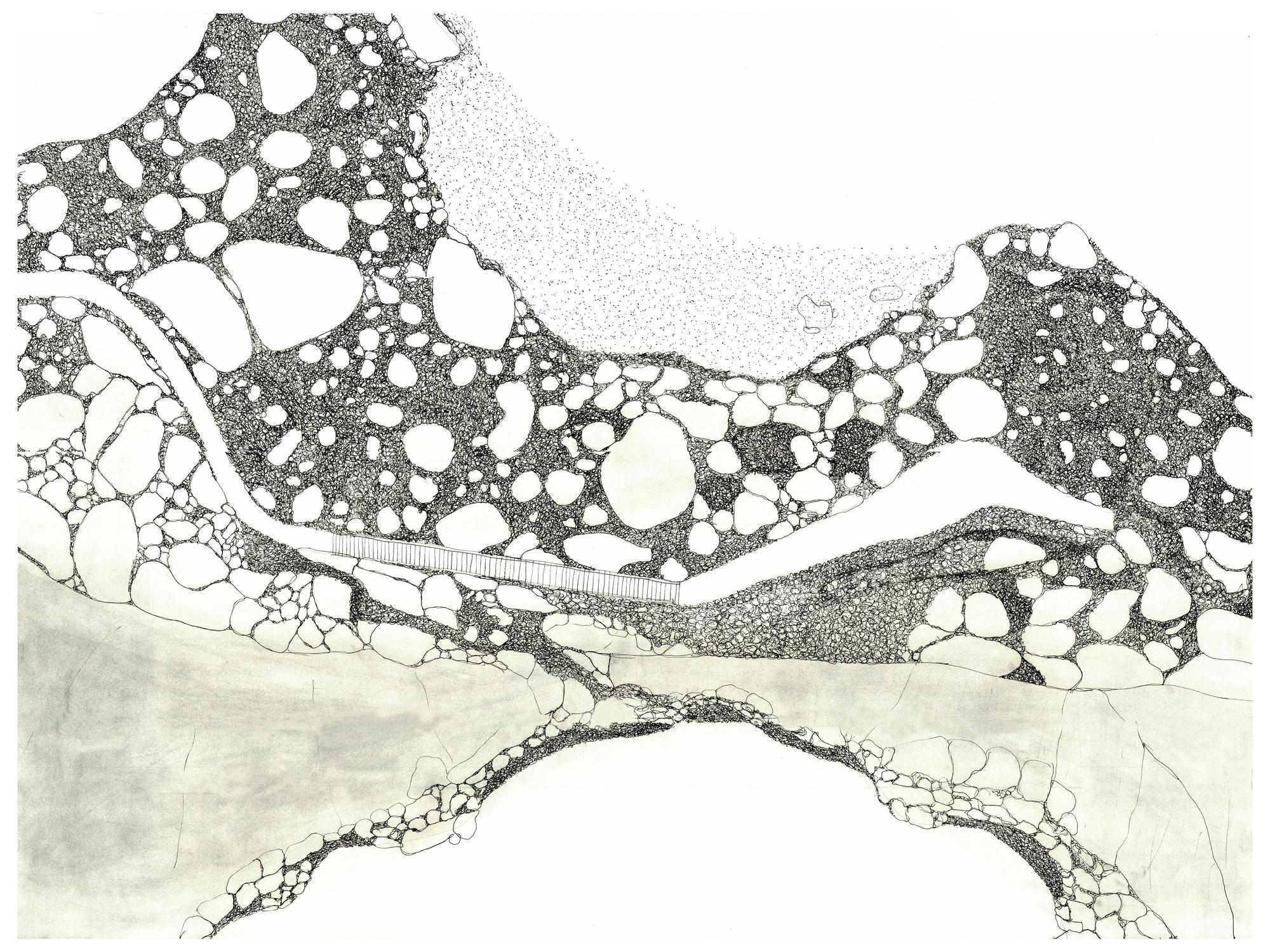
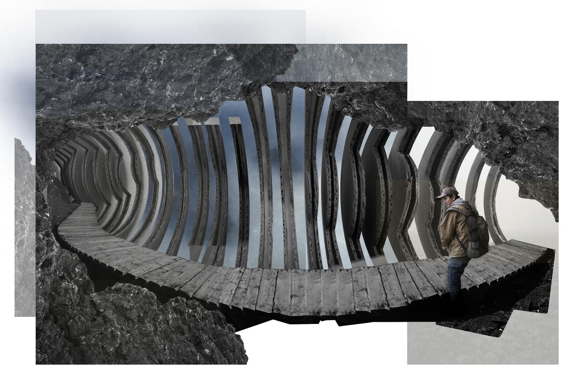
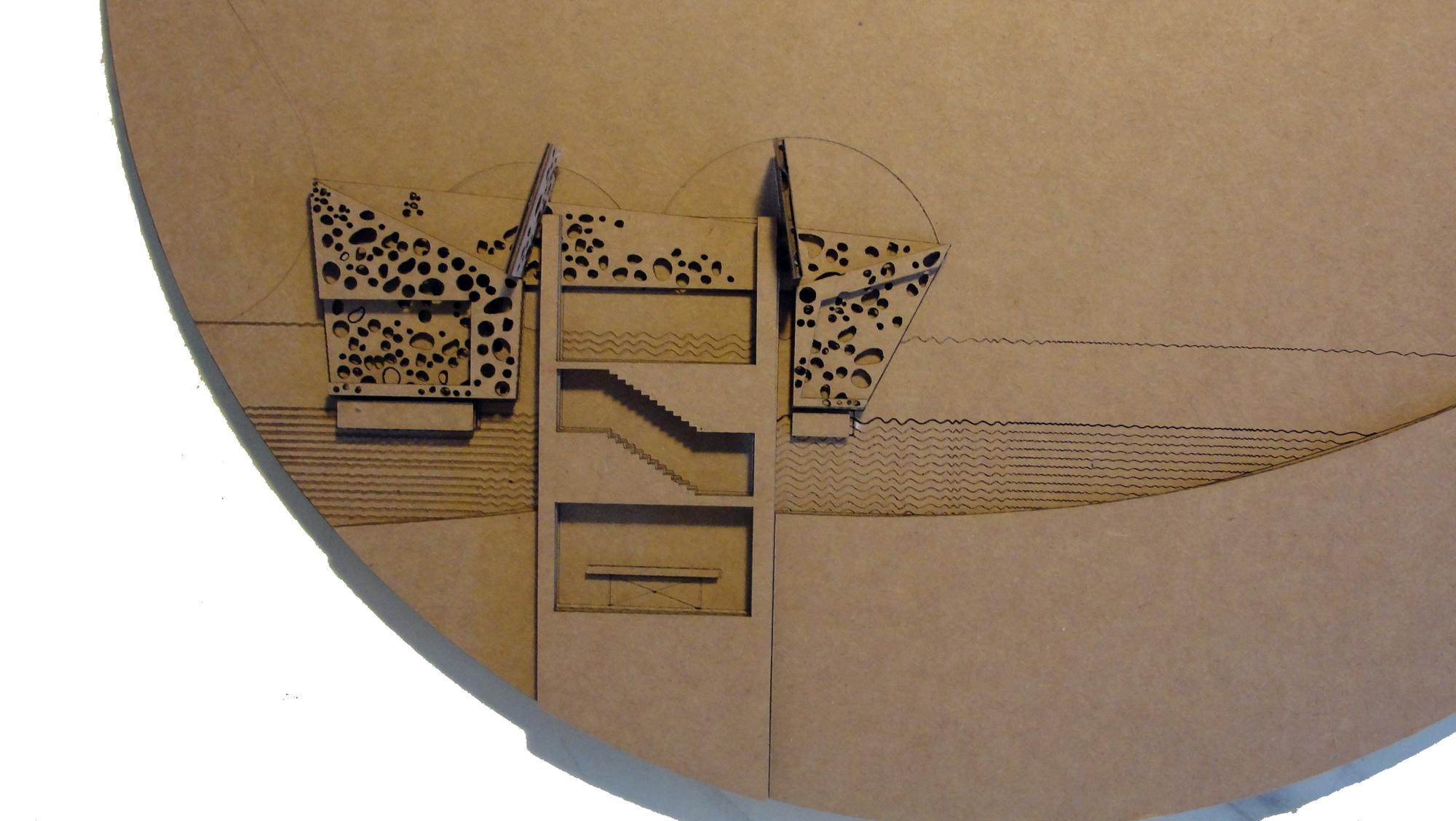
Students begin not by proposing a form for their intervention, but with a description of its intended effects within a notational graphic field. The second iteration of the Notational Overlay drawings depict Pt Bonita not as it is, but as it will be as a result of a proposed intervention. Based on this revised description of phenomenological affects, students explore the possible architectural forms that might produce it through two media: sectional relief model and a perspective montage. As neither of these media is capable of presenting a "complete picture" of our design proposal, we rely heavily on our ability to construct space using representations that present incomplete yet related descriptions of a form.


There's more!
Some other projects from this same class have been posted, as well as some interesting student work from this same year.