This exercise is intended to offer students a vehicle to develop graphic skills and techniques directly applicable to their studio work. As a response to the specific challenges of designing for the highly topographic landscape presented by the Point Bonita site, the learning objectives are twofold: first, to hone skills in 2d orthographic representation; and second, to develop competency in the three-dimensional modeling of architectonic elements set in relation to a natural topography.
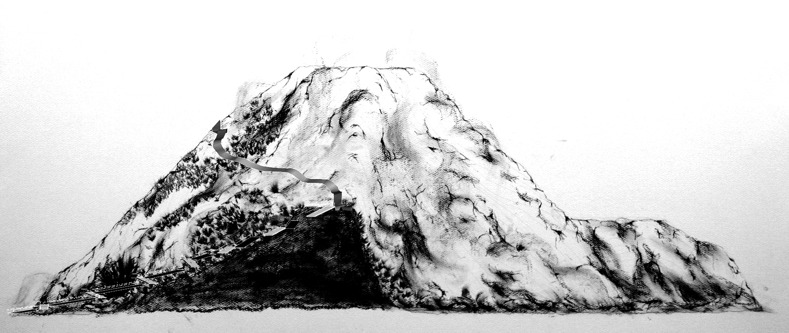
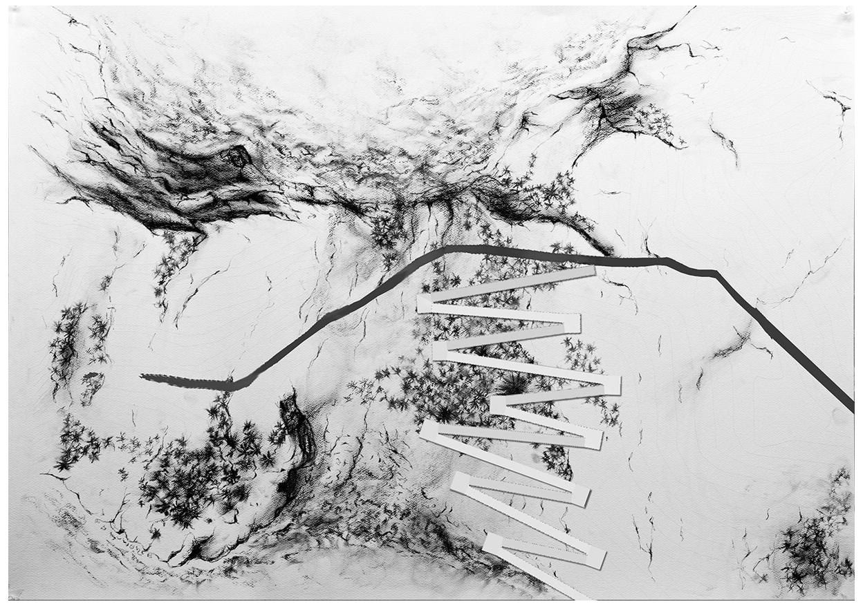
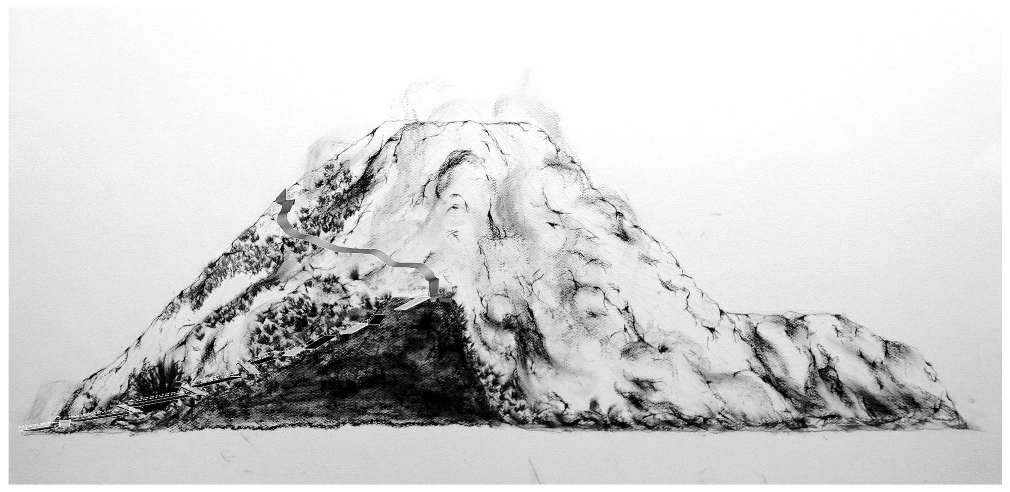
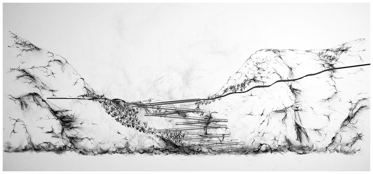
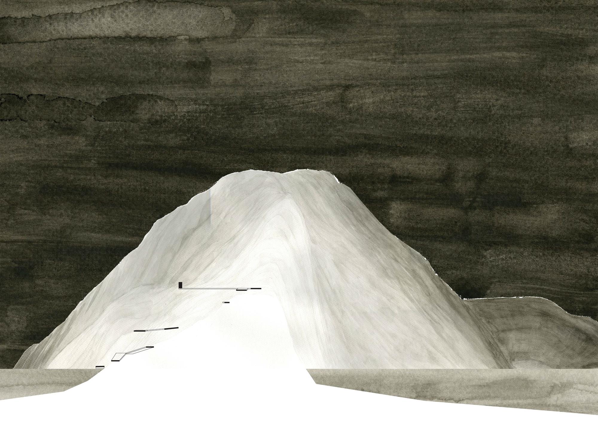
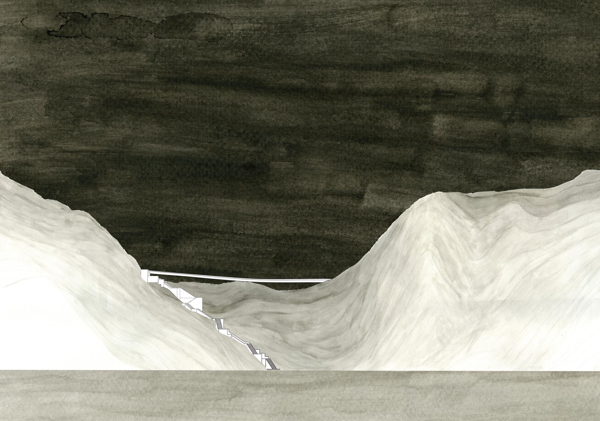
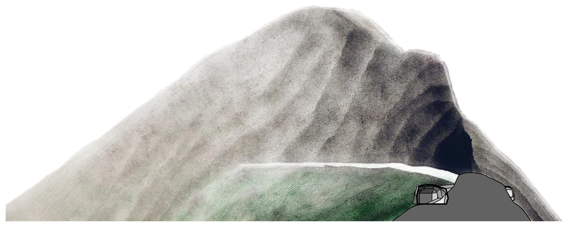
First, students hone their skills in the two-dimensional representation of the three-dimensional natural landscape. Starting with the base geometry of the given site contour lines and/or 3d surface in CAD, students produce three large-scale digital prints depicting a plan, a section, and an elevation of the Point Bonita site. These large-scale prints are then transferred to watercolor paper where additional information may be added through any media - hard-line pencil, freehand shade-and-shadow, watercolor, and colored pencil are all acceptable options. Using the variety of information sources available (photographs, site sketches, site visits), these hand-drawings are to be based upon the digital CAD model, and yet go beyond the information available in the digital format. The information included ought to reflect individual observations of the site. Note that the resulting drawing is to primarily operate as descriptive rather than diagrammatic, which is to say, while it does seek to emphasize particular phenomenological qualities of the site, it remains within the language of traditional orthographic representation.
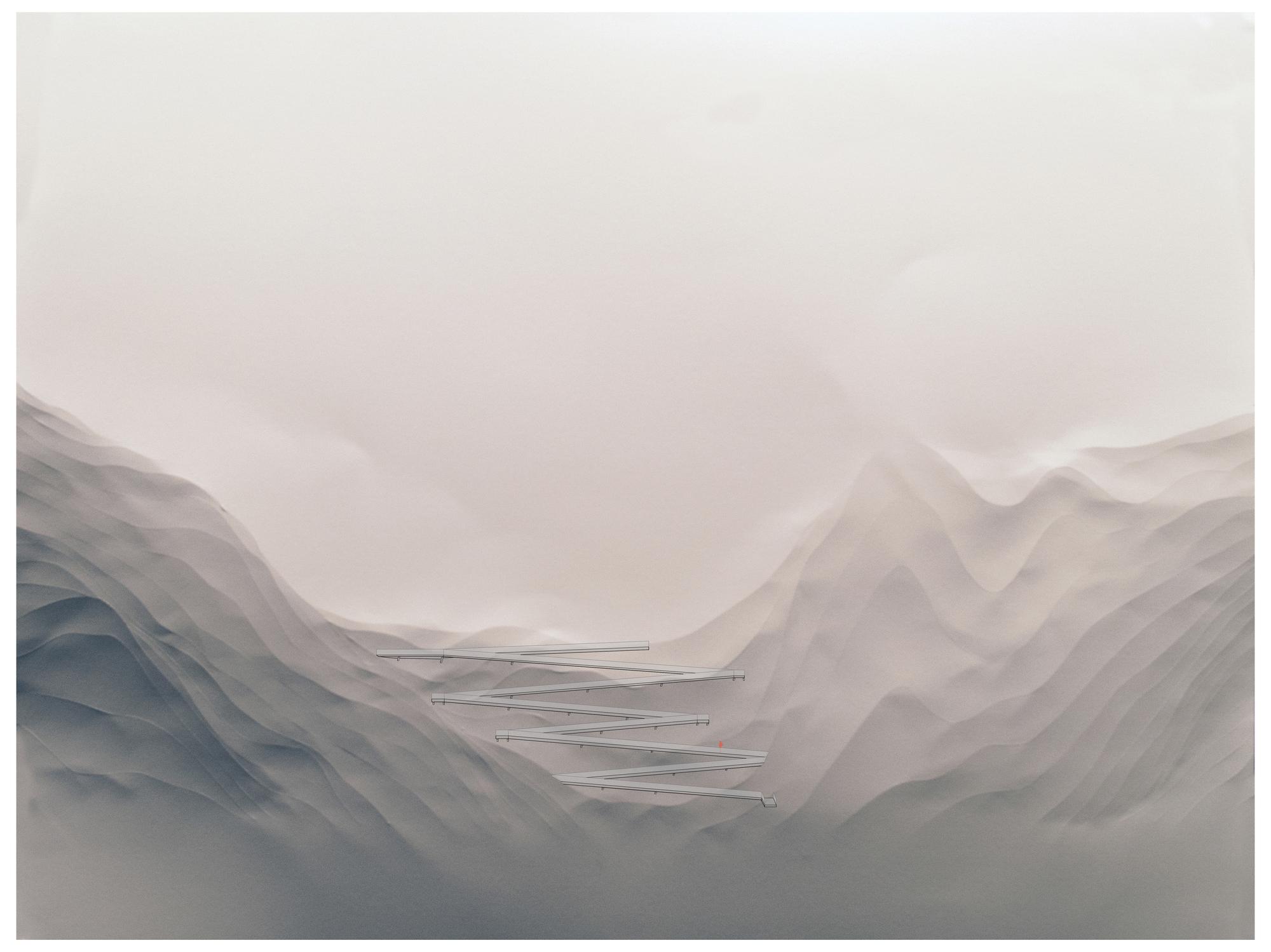
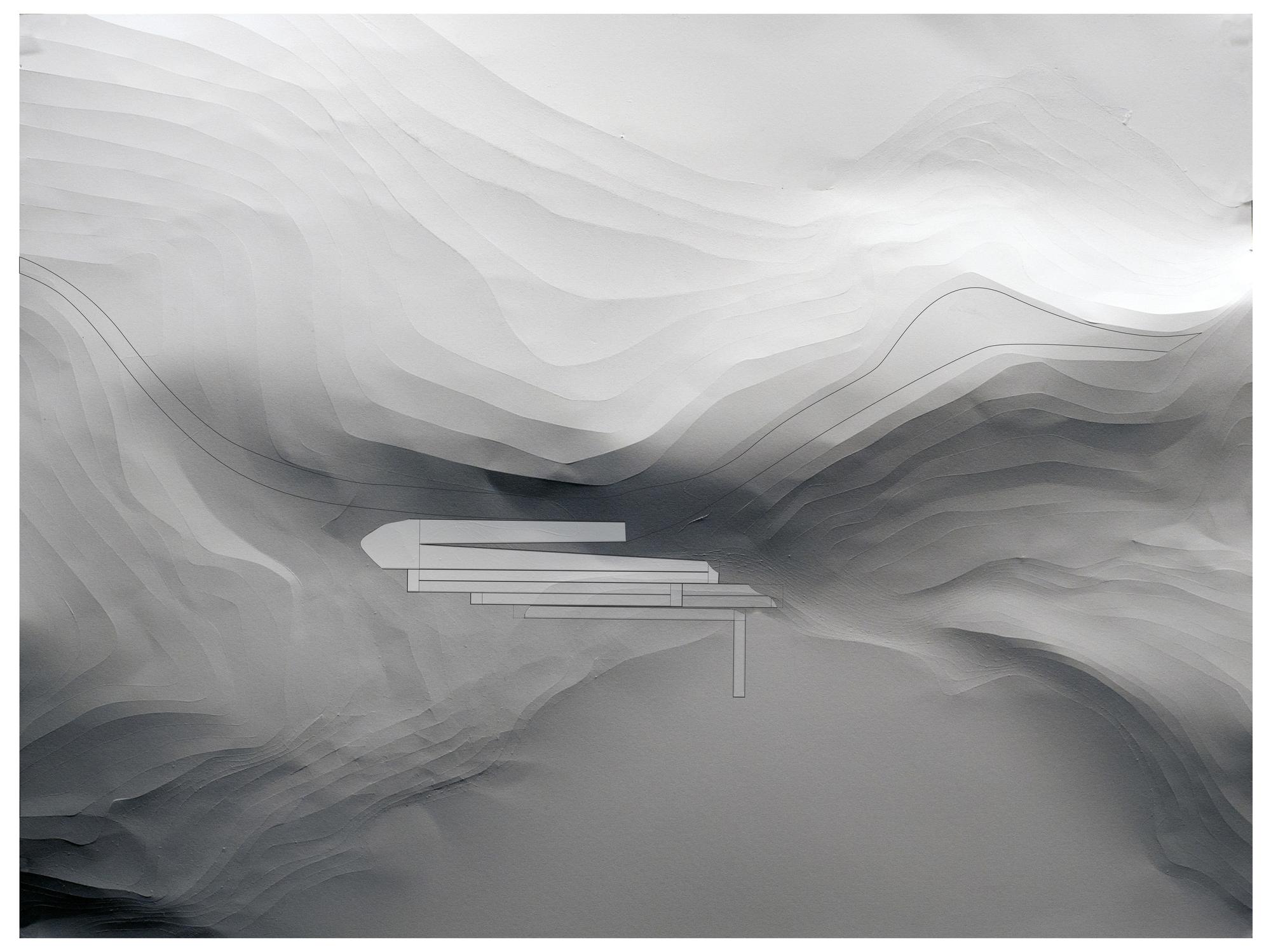
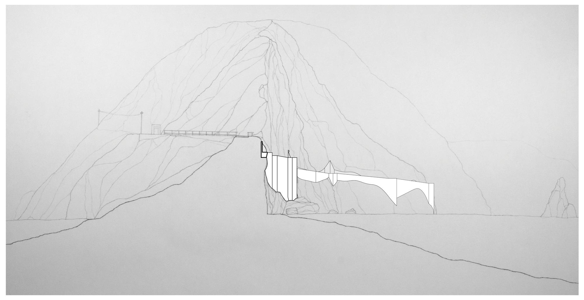
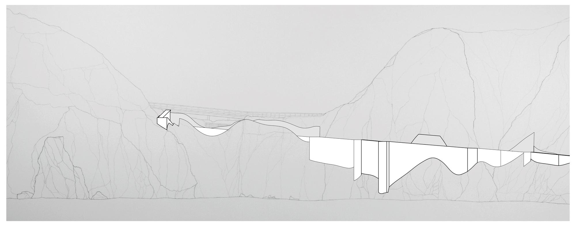
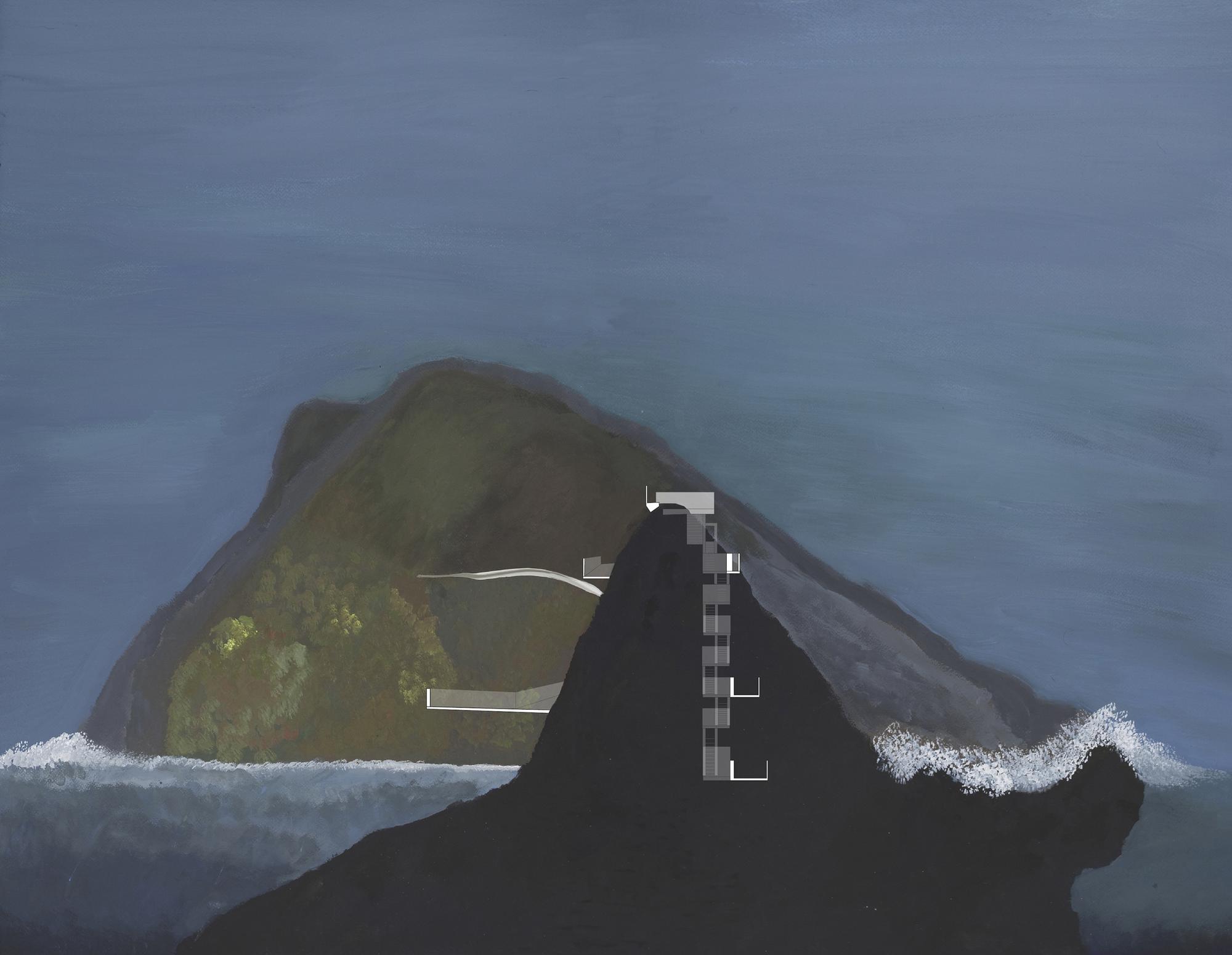
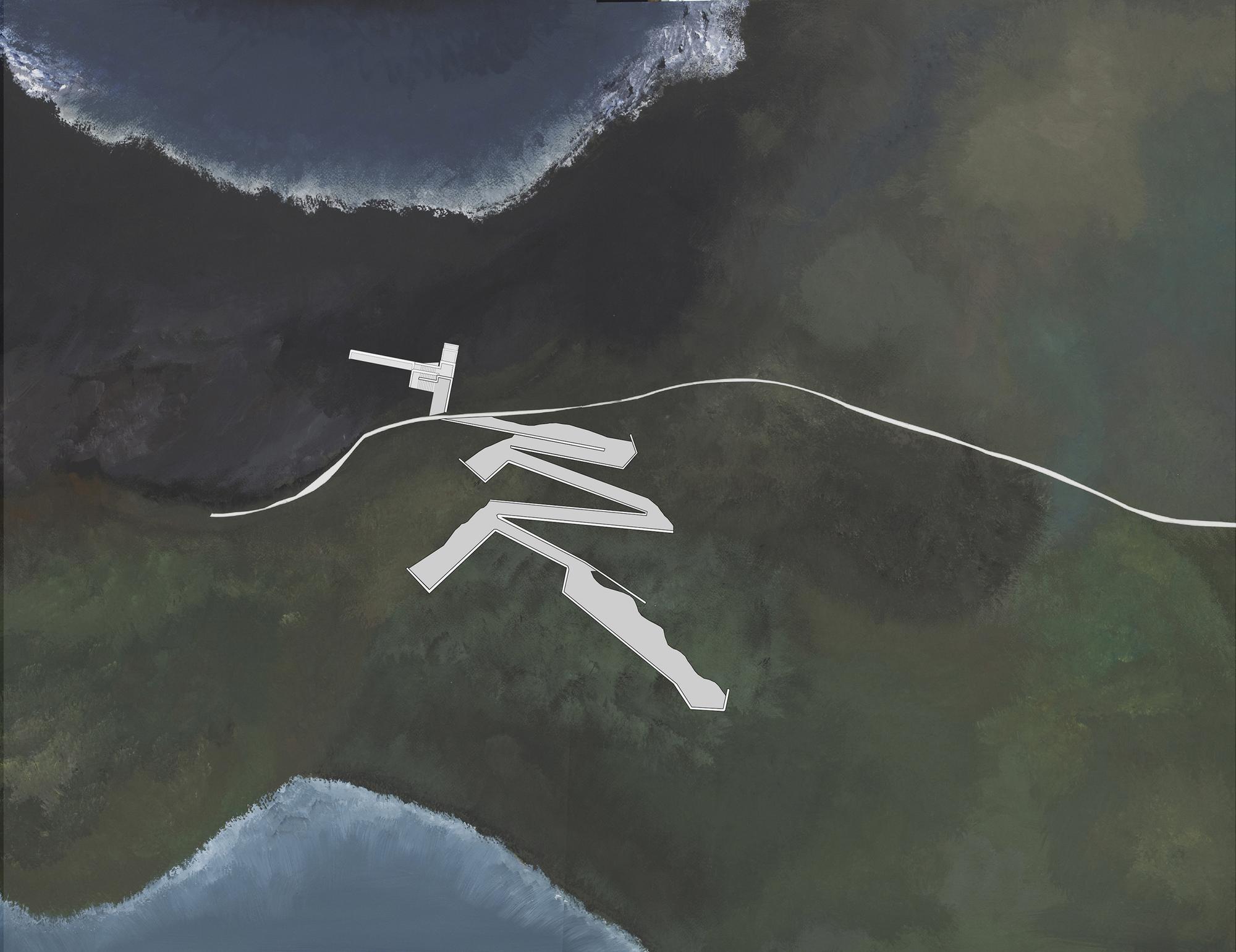
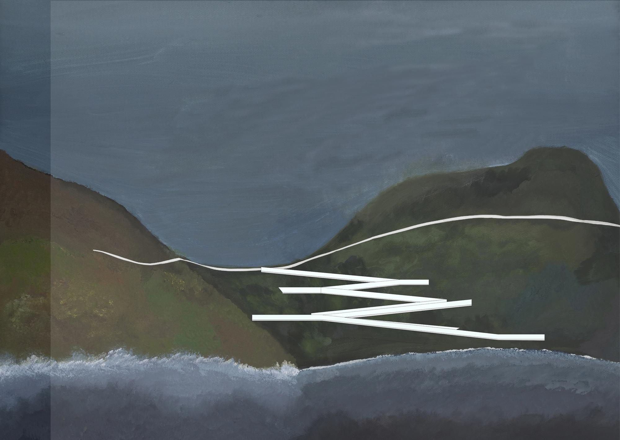
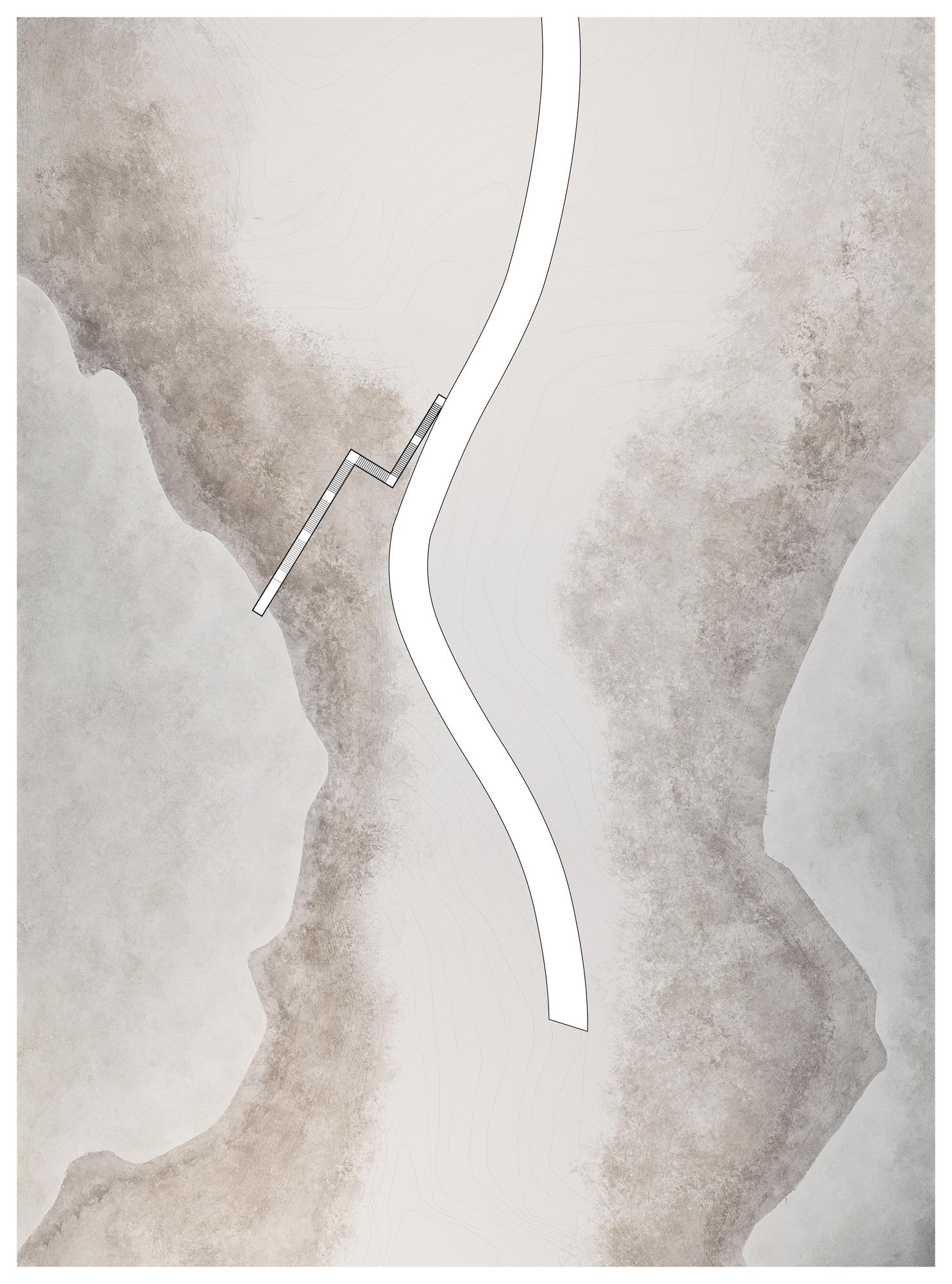
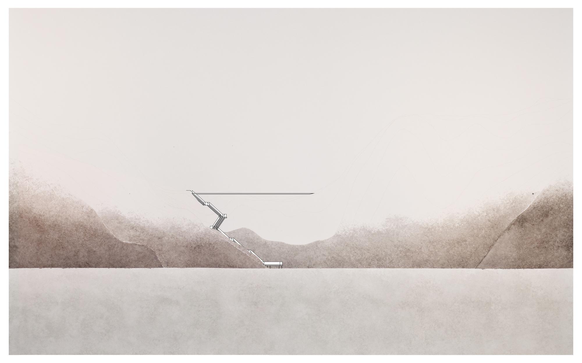
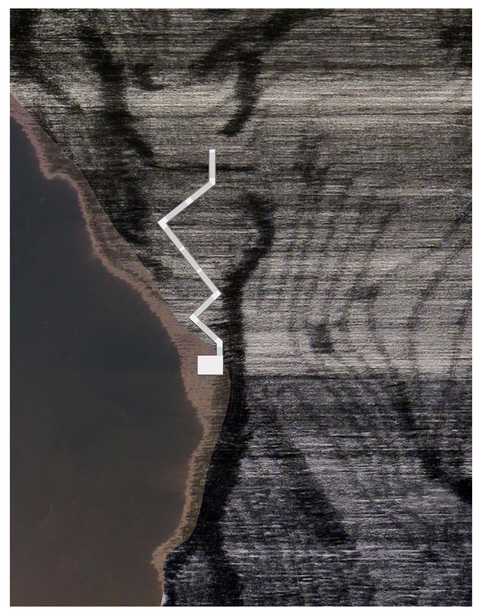
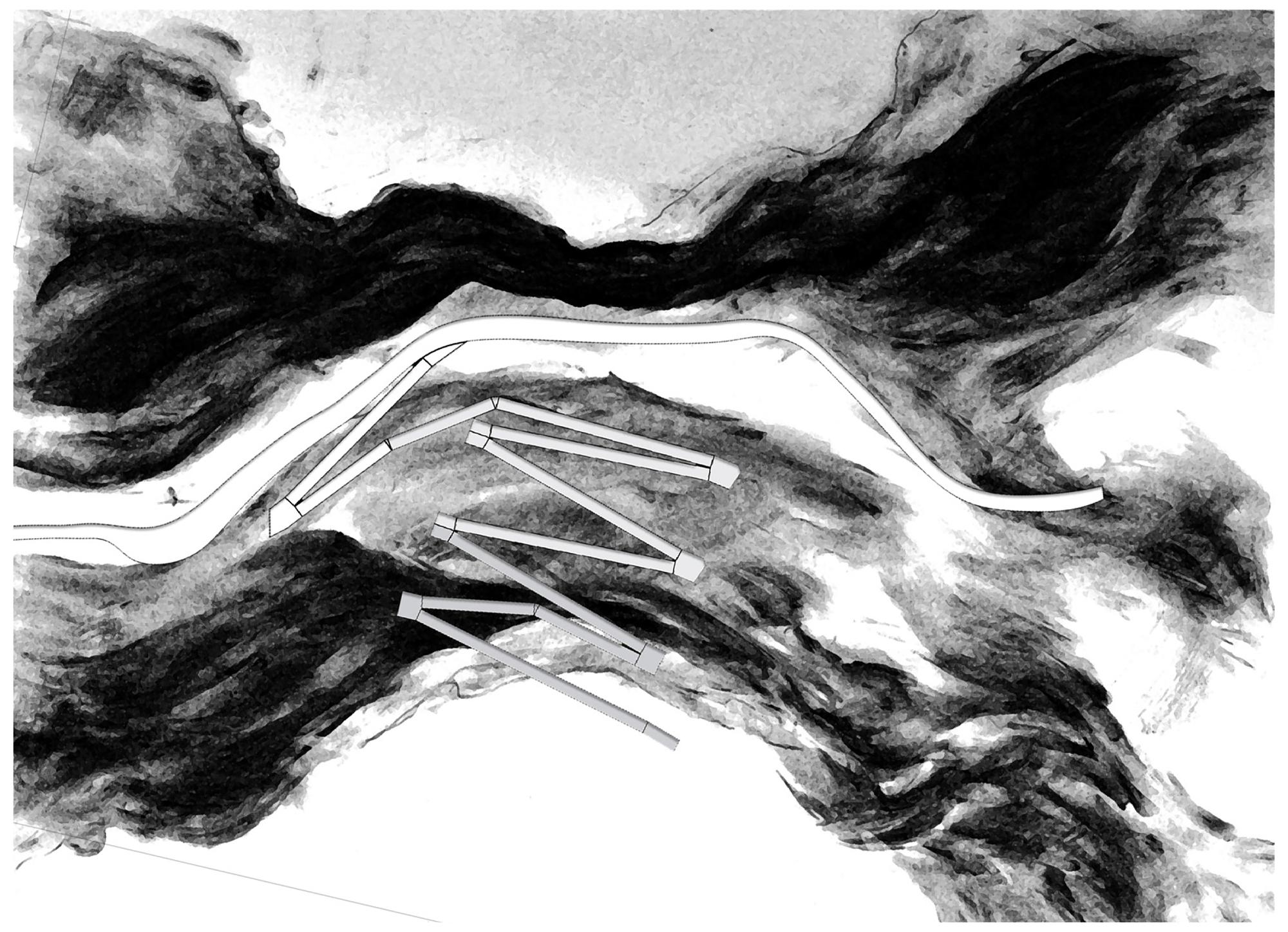
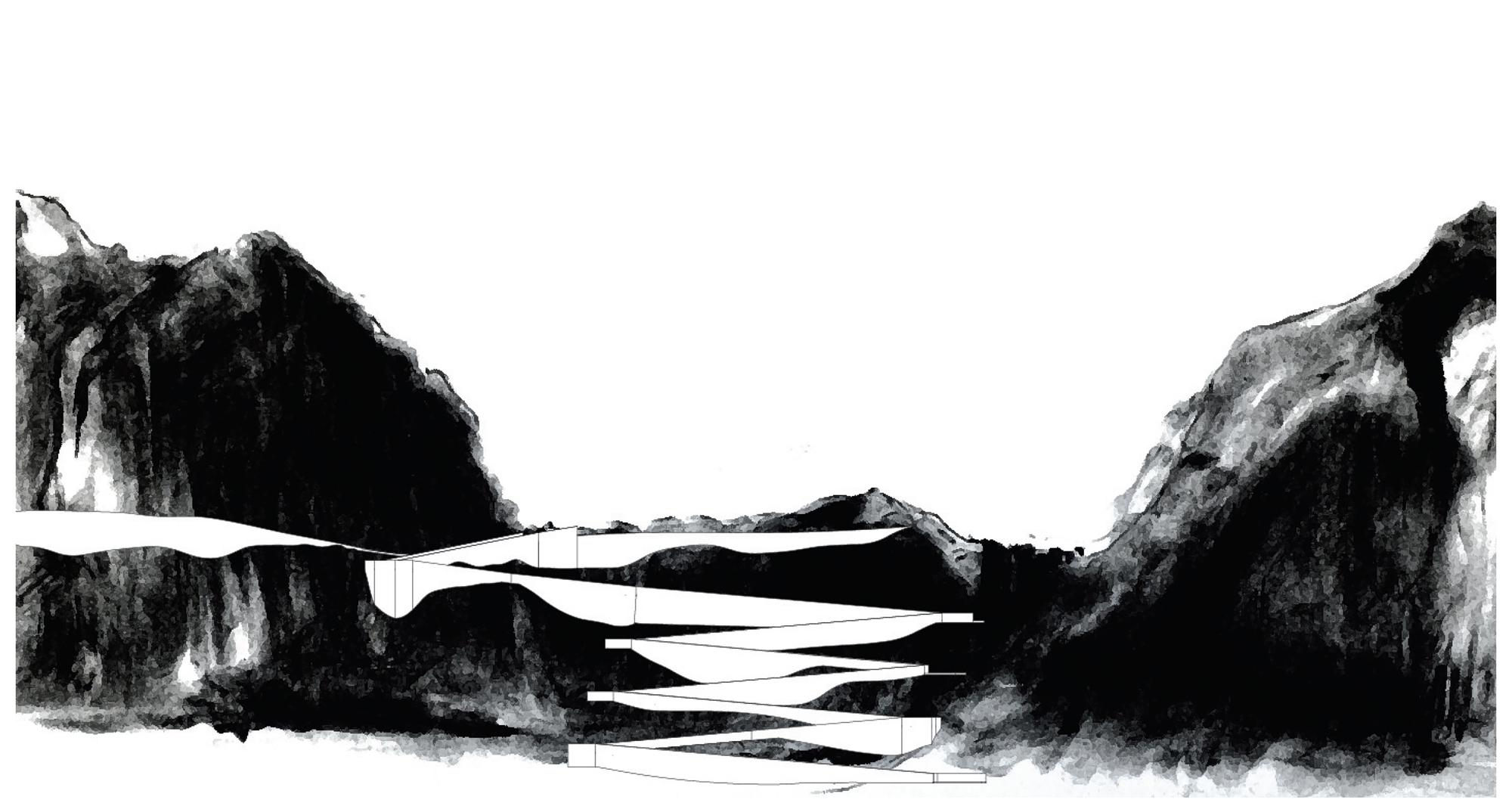
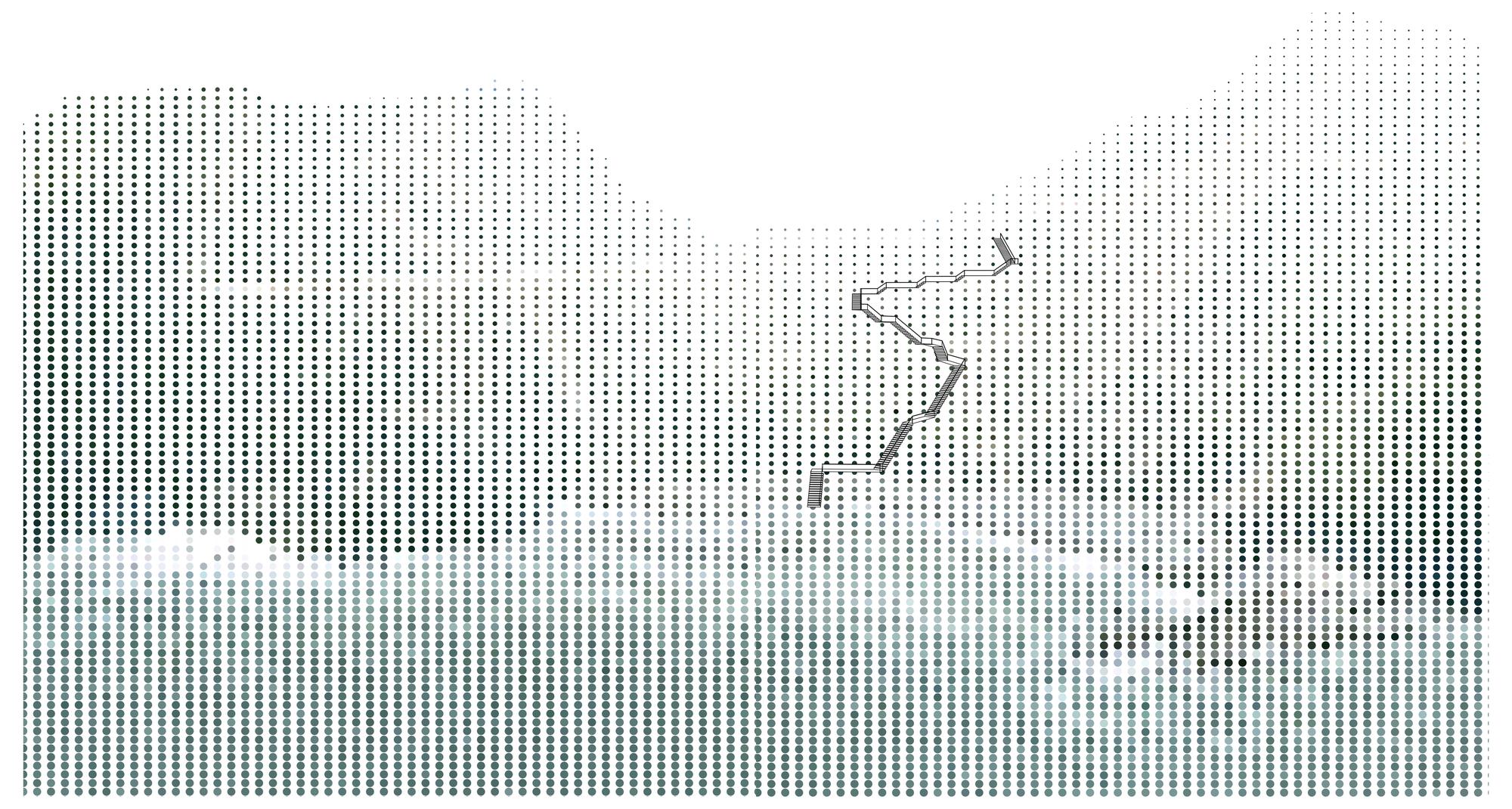
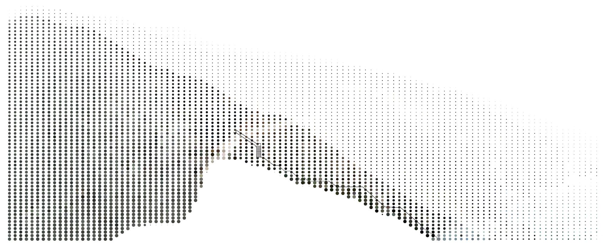
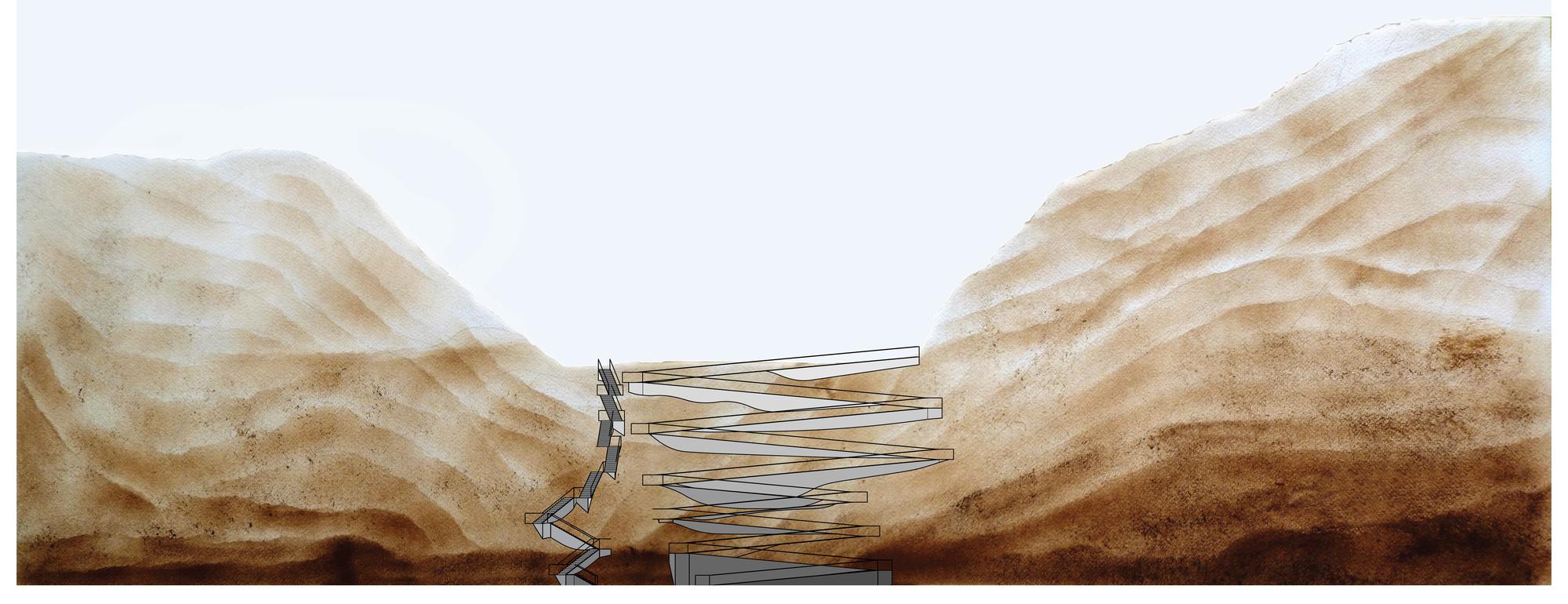
Next, students refine their competency in the three-dimensional modeling of architectonic elements set in relation to a natural topography. Working on the hill face depicted in the site elevation described above, students produce two separate designs for allowing access to the shoreline from the existing path on site: one via ramp and one via stair. The resulting design must be dimensionally accurate, in compliance with a loose building code, and plausible from a design point of view. Furthermore, the resulting model ought to be resolved completely - all surfaces should meet at clean edges, where manipulated by the design, the ground should be cut or built-up as appropriate, and details such as stair treads, retaining walls and handrails should be included.
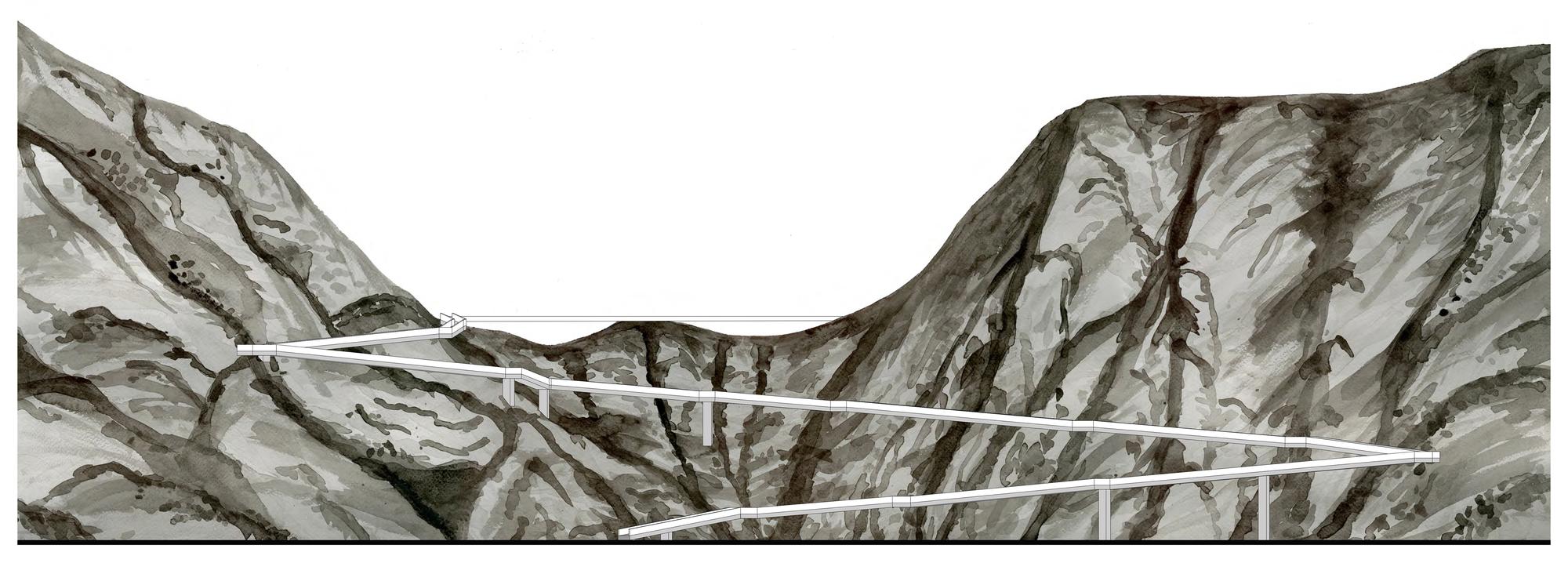
In a final step, we bring the previous two steps together by producing design drawings: students will produce plan, section, and elevation drawings for either their stair or ramp designs, resolved graphically with the site description drawings from step two.


There's more!
Some other projects from this same class have been posted, as well as some interesting student work from this same year.